
The Everest region is often represented by an isolated summit. A more useful view includes the ground around it: valleys, forested slopes, rock, glacial terrain and the settlements that connect a journey. Looking at those relationships gives the landscape depth and helps distinguish the mountain from the wider region.
UNESCO’s description of Sagarmatha National Park places mountains, glaciers, deep valleys and Sherpa settlements within the same protected landscape. The park is not an empty background. Natural processes and lived places overlap, and a visitor’s route passes through both.

Landing Everest Base Camp Kalapathar by Helicopter with Breakfast
Helicopter tour to Everest base camp:- Landing at Mt. Everest base camp, Kalapather with the best view of Mt Everest & other Himalayas, It is a landin...

Kathmandu Sightseeing | UNESCO World Heritage sites Private/Group
Embark on a captivating journey through Kathmandu with our Private Kathmandu Sightseeing Tour. Led by our expert Eng...

Kathmandu: Full Day 7 UNESCO Tour with Lunch - Private/Group
The Seven World Heritage Day Tour of Kathmandu presents a distinctive convergence of history, culture, and spiritual...

Kathmandu Food and Drink Walking Tour
Namaste! Come hungry to explore Kathmandu's culinary wonders on an immersive walking tour led by a professional lice...
Start with the foreground
Before naming a distant peak, notice the nearer ground. A path, a stone wall or a group of buildings can make the scale of a photograph more understandable. Foreground details also help distinguish one viewpoint from another. Two photographs facing different directions may show very different parts of the same valley.
This is why accurate captions matter. Namche, Khumjung, Tengboche and a glacier viewpoint are not interchangeable labels. If the source identifies only a broad region, keep the caption broad. Do not turn an uncertain identification into a precise claim simply because a mountain looks familiar.
Distinguish the peak, park and journey
| Term | What it describes | What it does not establish |
|---|---|---|
| Everest | The mountain on the Nepal–China border | A complete visitor itinerary |
| Sagarmatha National Park | A protected Nepal-side mountain landscape | Automatic access to every place shown in a photograph |
| A Khumbu trek | A particular journey through the region | A summit climb or a single standard schedule |
A base-camp journey is also distinct from an ascent of the mountain. Read descriptions carefully to understand their actual destinations and activities. A famous name in a tour title may cover several possible routes, so the detailed itinerary is the useful document.
Read glacial terrain with care
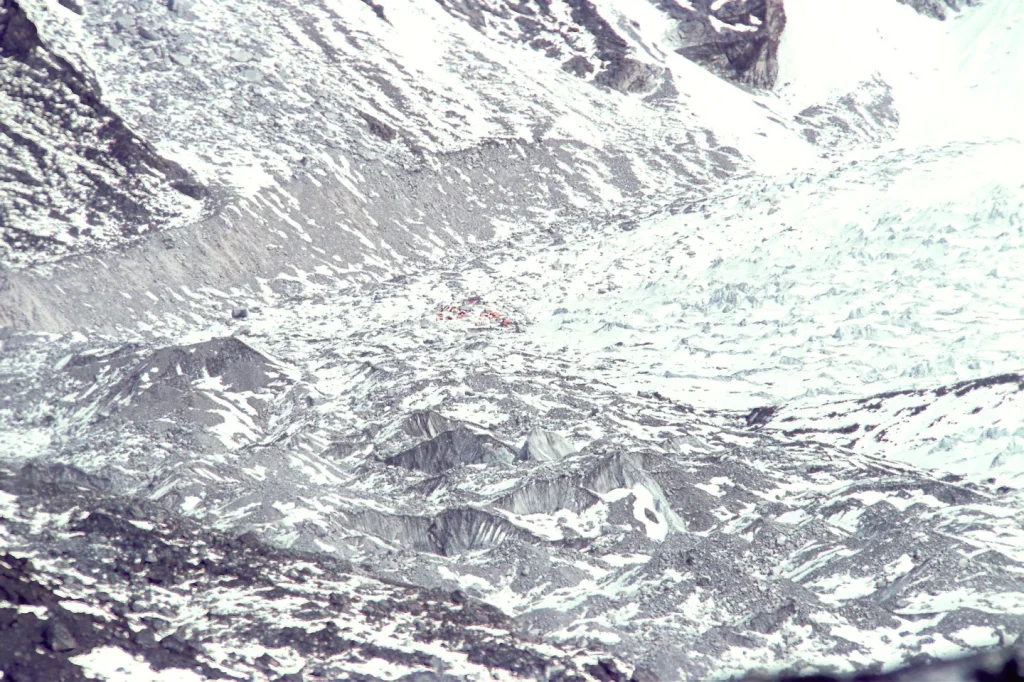
Photographs of the Khumbu Glacier can show broken surfaces, moraine and a much larger mountain setting. They document a viewpoint and a moment. They should not be used as a route map or evidence that a particular piece of terrain is accessible to a visitor.
Do not infer a safe path from a clear-looking photograph. Access and conditions require current local assessment. The purpose of a landscape essay is to improve understanding, not to provide technical navigation or replace qualified guidance.
Let weather remain visible
Cloud can reveal some forms and conceal others. A photograph made in bright light should not become a promise that every visit will have the same view. Likewise, an overcast image is not a lesser version of the place. Changing conditions are part of how the region is experienced.
When planning a photography-focused visit, separate the images you hope to make from the arrangements you need. Discuss flexibility, appropriate locations and the limits of a proposed route. No itinerary can guarantee a particular sky, visibility or encounter.
Keep the inhabited landscape in view
Stone buildings, fields, shops and paths belong in the same story as snow and rock. They are evidence of work and community life, not decorative foreground. Ask questions respectfully and avoid assigning cultural meanings to objects or practices without a reliable explanation.

.jpg)
Private Bhaktapur and Nagarkot Day Tour From Kathmandu
The day trip to Bhaktapur and Nagarkot from Kathmandu takes you to the ancient city of Bhaktapur and the most popular Himalayan viewpoint closer to Ka...

UNESCO Seven World Heritage Tour in Kathmandu
There are seven awe-inspiring UNESCO World Heritage Sites in the Kathmandu Valley. Dating back over 2000 years, the...

Kathmandu: Full Day Top 4 UNESCO Tour with Lunch - Private/Group
A Kathmandu sightseeing tour is a captivating journey through Nepal's rich cultural and spiritual heritage. Start yo...

ZipFlyer Nepal - The World's Steepest Zip-line
Welcome to the most stunning Zipline on the planet. Zipflyer Nepal is a 1.8km Zipline located in Pokhara Nepal with...
For a closer view of a settlement, read Namche as a place. For practical comparison, the trek comparison guide helps distinguish different kinds of regional journey without ranking them by height or achievement.
Geographic background: UNESCO’s Sagarmatha National Park entry and Nepal Tourism Board’s Everest overview. Photo locations and licenses are recorded in the credits.